
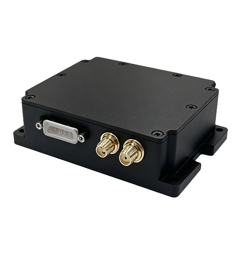
VINS-D15
Visual-Inertial Fusion Navigation System
Product Overview: Visual-Inertial Fusion Navigation
The VINS-D15 visual-inertial fusion navigation system adopts high-precision MEMS inertial sensors fused with visual navigation algorithm, built exclusively for UAV platforms. This MEMS inertial navigation drone module integrates high-performance MEMS gyroscopes, MEMS accelerometers and GNSS receiver chips. It measures angular rate and acceleration of the UAV, accepts real-time GNSS dual-antenna and heading inputs, and runs navigation computation to output real-time heading, 3D velocity, position and attitude data for drones. It maintains the published navigation accuracy under GNSS-denied conditions across desert, forest and lake environments. As a reliable solution for GNSS-denied navigation for UAV, it solves positioning drift and failure when satellite signals are blocked or intentionally jammed, ideal for applications requiring GPS denied navigation for drone in complex terrain.
Core Advantages
The VINS-D15 supports full-band GNSS reception with ultra-low 3W steady-state power consumption and a built-in adaptive attitude algorithm. When GNSS satellite signals drop out, the internal self-correction logic holds stable horizontal attitude accuracy during UAV flight. It supports RTK differential input, zero velocity update and flight constraint algorithms to deliver reliable dead reckoning. Unlike basic inertial modules that accumulate large drift quickly without GNSS, this visual-inertial fusion design leverages visual feature matching to constrain navigation error continuously for longer-duration flights.
Key Features
- Full-band GNSS signal reception
- Ultra-low power consumption: ≤ 3W
- Built-in adaptive attitude solving algorithm
- Attitude retention via self-correction under GNSS outage
- Compatible with RTK differential correction input
- Zero velocity update & flight constraint algorithm
Main Applications
- UAV positioning and dynamic attitude measurement
- Aerial mapping and photogrammetry survey
- GNSS-denied navigation over deserts, forests and lakes
- Aerial inspection & surveillance missions
- Flight dynamic attitude reference system
Performance Specifications
| Category | Parameter Item | VINS-D15 |
|---|---|---|
| Integrated Navigation Accuracy | Combined Heading (°,1σ, real-time) | 0.15 (1m baseline dual-antenna) 0.5 (single antenna, dynamic) |
| Combined Horizontal Attitude (°,1σ, real-time) | 0.05° (Dual-antenna) 0.1° (Single antenna) |
|
| Combined Horizontal Position (m,1σ) | 3m (Single point) 0.02+1ppm (RTK) |
|
| Combined Vertical Position (m,1σ) | 5m (Single point) 0.03+1ppm (RTK) |
|
| Combined Horizontal Velocity (m/s,1σ) | 0.1 | |
| Combined Vertical Velocity (m/s,1σ) | 0.15 | |
| Pure Inertial Accuracy | Horizontal Attitude (°,1σ, real-time) | 0.05° (Static) 0.5° (Dynamic) |
| Heading (°,1σ, real-time) | 5° (Dynamic) | |
| Depth Measurement Accuracy (cm) | 5 | |
| Inertial / Odometer Dead Reckoning | ≤ 0.001D | |
| Electrical & Mechanical Interface | Power Supply (V) | 9~36 |
| Steady-state Power (W) | ≤ 3 | |
| Start-up Time (s) | ≤ 2 | |
| Communication Interface | 1×RS-422, 1×RS-232, 1×CAN | |
| Update Rate (Hz) | 200 (Customizable) | |
| Dimension (mm×mm×mm) | 83×66×23.8 | |
| Weight (g) | ≤ 350 | |
| Operating Environment | Operating Temperature (℃) | -45 ~ +80 |
| Storage Temperature (℃) | -55 ~ +85 |
Integration Notes
The VINS-D15 is purpose-built for UAV integrators working in challenging outdoor terrain. It holds specified positioning accuracy in GNSS-denied scenarios such as deserts, forests and lakes, delivering continuous positioning when GNSS is jammed or unavailable. The fusion algorithm tightly couples visual observations and inertial measurements to suppress long-term drift. It supports standard serial and CAN bus protocols for straightforward integration with flight controllers, autopilots and onboard computers. NovaSys provides formal datasheets, wiring guides and technical support for bulk orders. It is widely selected by aerial survey teams and drone developers who require reliable positioning without stable satellite coverage.
FAQ
What is the main advantage of this navigation unit?
VINS-D15 is a UAV-only visual-inertial fusion navigation unit. It maintains stable attitude and position output for drones when GNSS signals are lost, preserving stated accuracy over deserts, forests and lakes.
Can the output frequency be adjusted on this MEMS inertial navigation drone module?
Yes, the default update rate is 200Hz and it can be tuned according to your UAV project requirements to match flight controller sampling needs.